Erosion and flooding risks
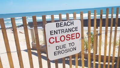
Coastal erosion is a global phenomenon. One quarter of France’s coastline is currently retreating. What can be done to protect the coast from the onslaught of the sea? What is coastal erosion? What is the impact of climate change on this phenomenon? These are some of the questions we will seek to answer in this lesson. To understand how French coastlines are impacted by the risks of coastal erosion and flooding, take a look at our interactive map.

The European Commission's support for the production of this publication does not constitute an endorsement of the contents, which reflect the views only of the authors, and the Commission cannot be held respnsible for any use which may be made of the information contained therein.
What is coastal erosion?
It is a natural process caused by multiple factors such as wind, waves, currents or surface runoff. This phenomenon is also determined by the characteristics of the site (sandy, rocky, etc.). Coastal erosion results in the retreat of the coastline, meaning, the landward displacement of the shoreline due to the loss of materials (sand, rocks, sediments).
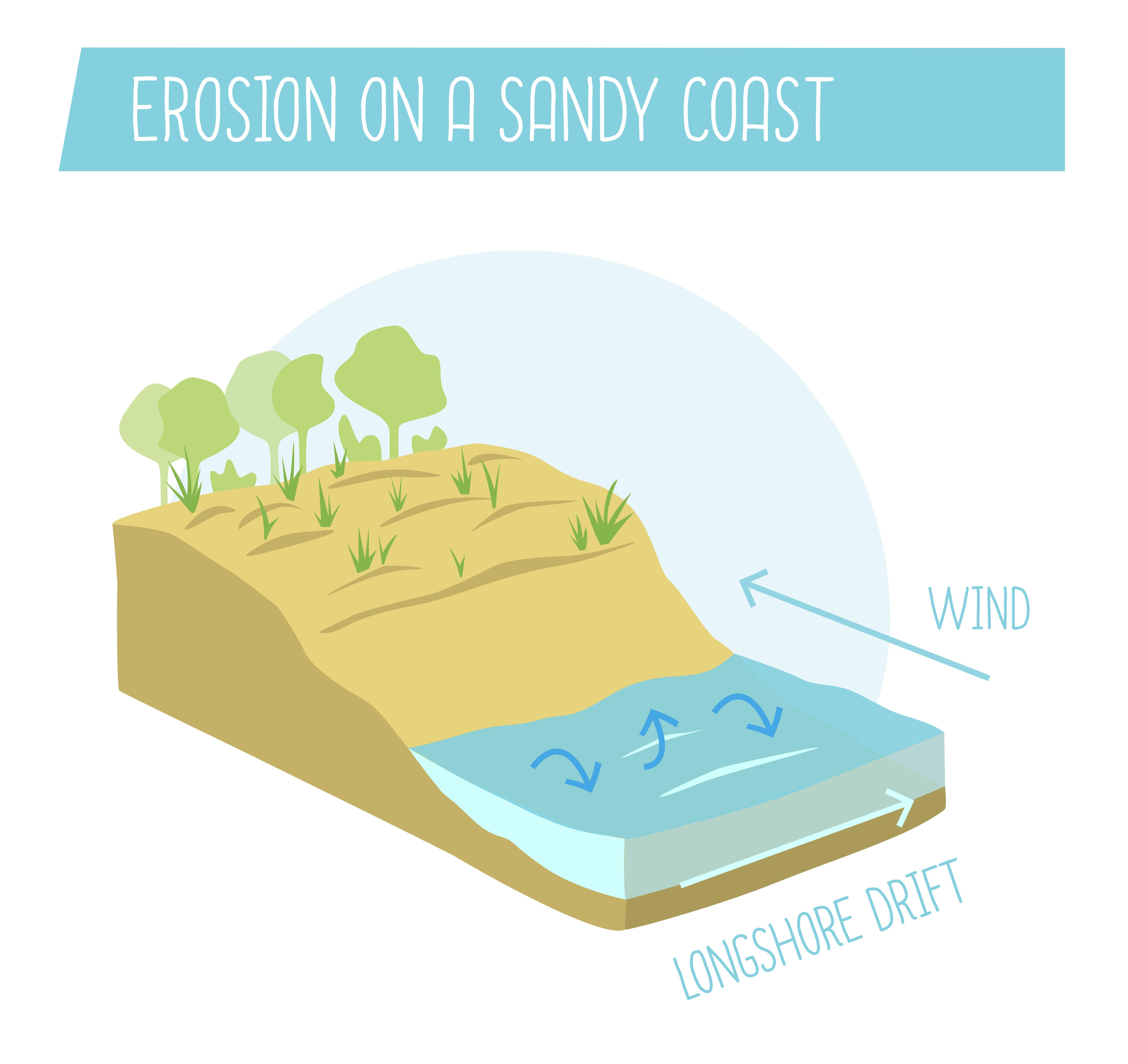
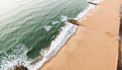
Sandy coast
The sandy coast is naturally always moving and changing. Wind moves the sand landward while waves and currents transport the sand out to sea.
Without human intervention, sediment transport is more or less balanced. In winter, the waves transfer the sand from the foot of the dunes to the shallow coastal areas. The sand then moves back up during calm periods under the action of the swell and the tides.
Some areas have a more or less regular sediment supply which replenishes the stock of sand lost due to erosion. Other areas shrink, as there is no replenishment.
As a general rule, the sand is carried away by longshore currents. This is called longshore drift. On the Atlantic coast, longshore currents travel from north to south and thereby move the sand in this direction.
The natural slope of the beaches also influences their resistance to the assaults of the waves. The steeper the seabed, the greater the erosion. When the gradient of the seabed is gentle, wave energy is dissipated and the phenomenon of erosion is slowed.
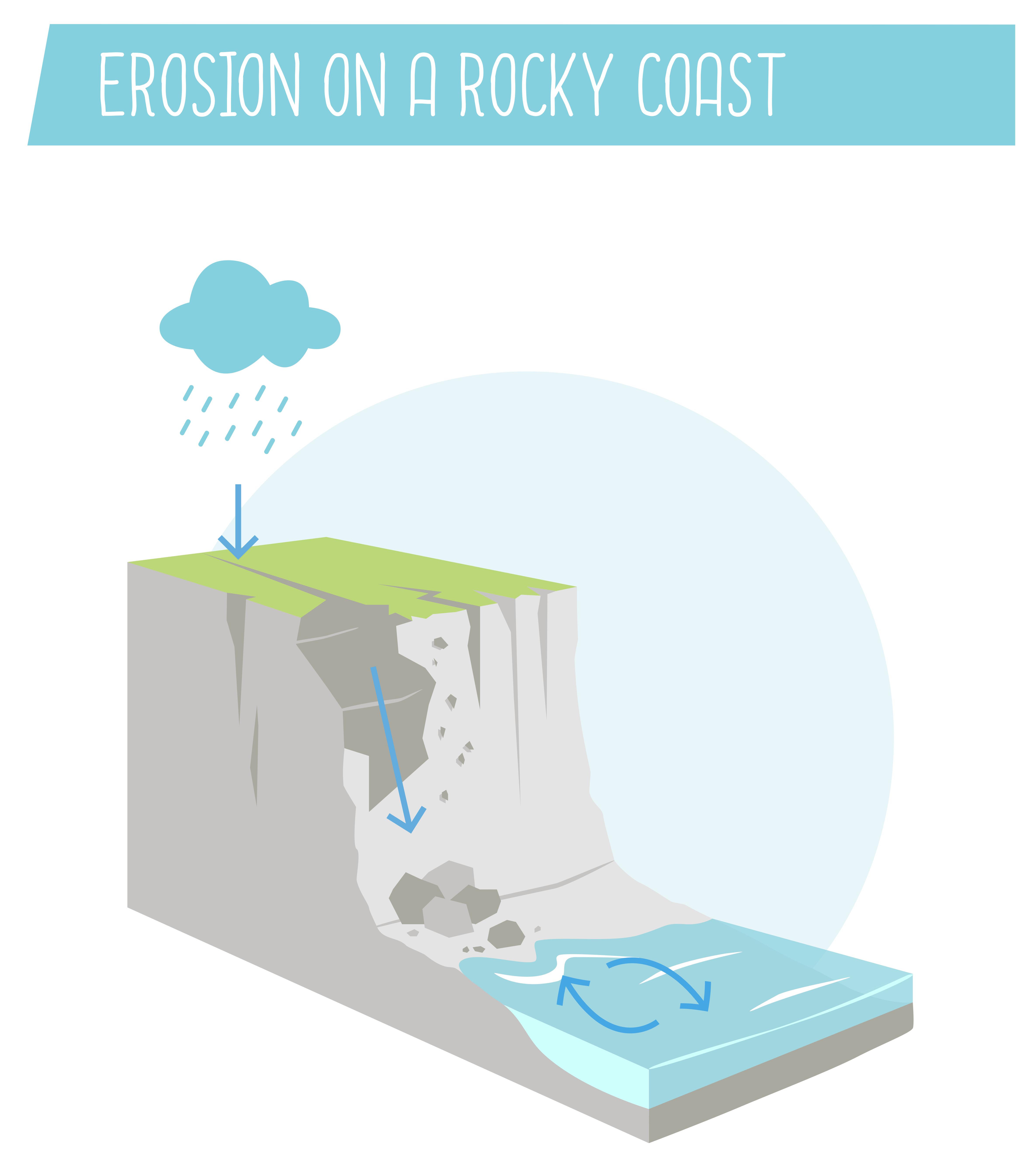
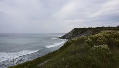
Rocky coast
The process of erosion is much slower on a rocky coast than on a sandy coast. The speed of erosion depends especially on the nature of the rock. A granite cliff for example, will be much more resistant than a limestone cliff which can be eroded by up to several metres over a short period.
Surface runoff plays an important role here. Rainwater infiltration, aided by plant roots as well as ice, favours the formation of cracks which weaken the rock. At the same time, the waves which pound the bottom of the cliff also have a mechanical impact and hollow out the rock which can cause the collapse of entire rock faces. This double phenomenon has a significant impact on our coasts and gradually causes our shoreline to retreat.
What is coastal flooding?
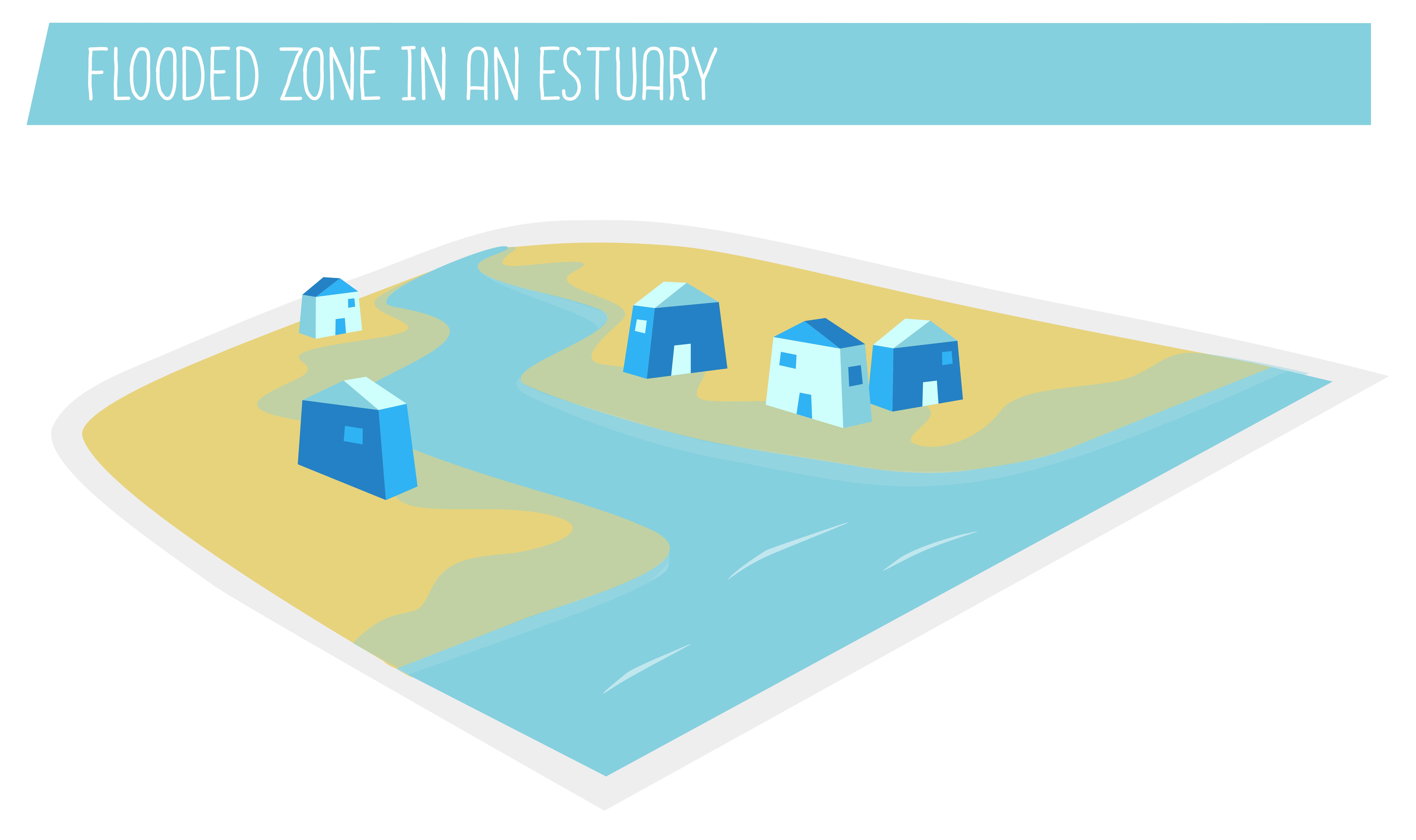
Coastal flooding, also called submersion, is the temporary or permanent flooding of a coastal zone by the sea. Coastal flooding due to storms or hurricanes can in some cases cause protection structures (such as dykes or dunes) to burst. This phenomenon can be particularly spectacular due to its speed and violence. It mainly concerns coastal areas near estuaries.
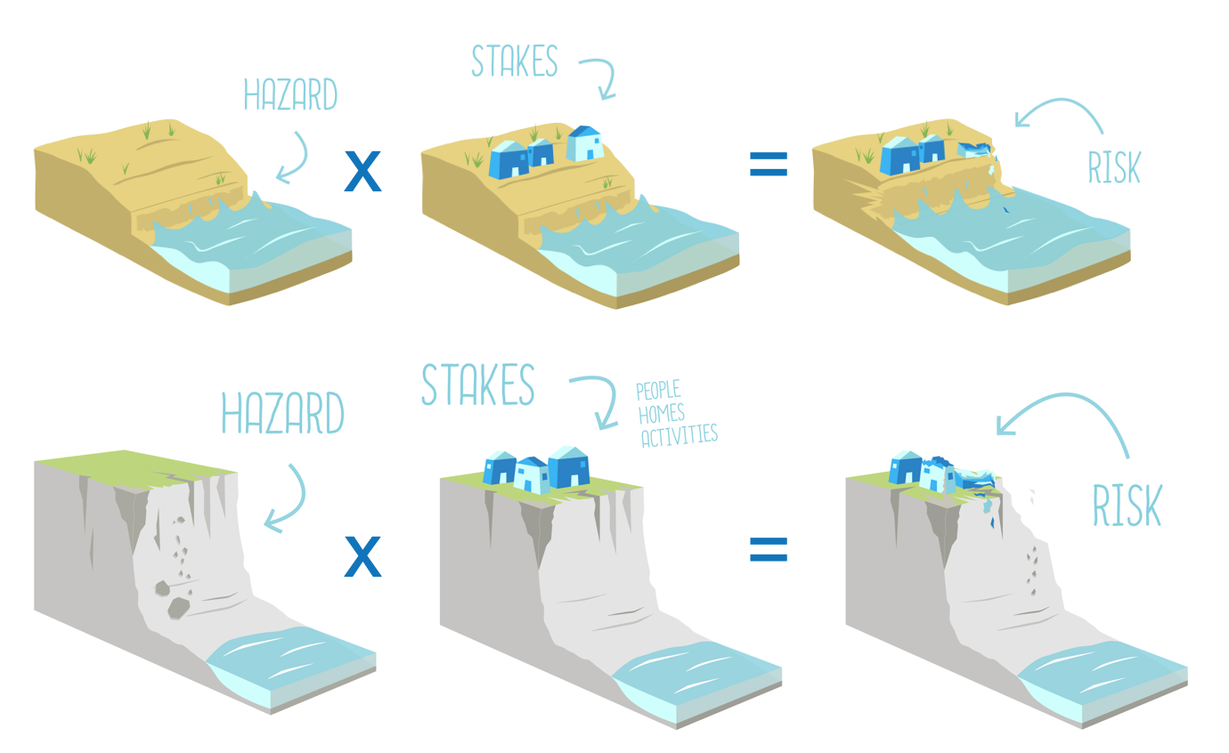
What is a “risk”?
The influence of climate change
One of the major consequences of climate change is the melting of terrestrial ice and the warming of ocean water (an increase in the temperature of water leads to an increase in its volume). This phenomenon causes a rise in sea levels. The IPCC currently predicts that by 2100 sea levels will rise by between 80 cm and 1.10 m.
This phenomenon will cause an increase in the high tide level on shores, notably in estuaries. With equinoctial tides or strong swell, the impact of waves will therefore be stronger on the coast and reinforce the erosion and flooding processes.

What can be done to protect the coastline?
As erosion is inevitable, humans have no choice but to adapt. The influence of rising sea levels must also be taken into account when predicting erosion and flooding risks in order to choose an appropriate long-term strategy.
The 4 coastal risk management strategies
To deal with the risks of erosion and flooding, four categories of coastline management strategies can be done.
1/ Engineering strategy
This means creating structures such as sea walls or rock groynes to prevent land being lost to the sea.
2/ Adjustment or reinforcement of natural processes
This consists in supporting natural processes to slow down erosion. For example, in a sandy environment can be installed wooden barriers (sand fences) to trap the sand.
3/ Relocation or strategic retreat
Relocation or strategic retreat is the last resort in the face of the advancing sea and consists in moving property or activities landward.
4/ Passive monitoring
By monitoring a coastal area, the coastline’s evolution can be regularly measured. This strategy is obviously time-limited and must be backed up by a management strategy.
These strategies are implemented by local authorities in line with the regulatory contexts, the development objectives and the stakes to be protected. These stakes may be human, economic, social or environmental.
Glossary
Coastline: the line that forms a boundary between the land and the sea. It is sometimes difficult to define on a coast in constant movement such as a sandy coast. In the case of sandy coast = boundary formed by the foot of the dune; of rocky coast = boundary formed by the top of the cliff.
Sediments: all the particles suspended in water which are eventually deposited under the effect of gravity.
Hazard: natural unpredictable phenomenon of a given intensity and probability of occurrence.
IPCC (Intergovernmental Panel on Climate Change): United Nations organisation responsible for, among other things, monitoring changes in Earth's climate.